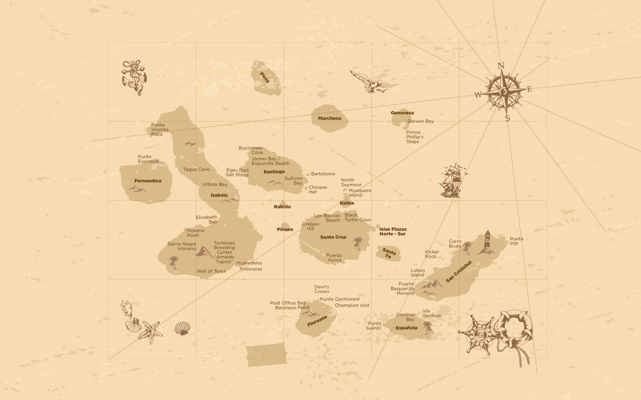
Experience Galapagos

Pick the best Galapagos Experience for you!

We recommend you to rotate your phone's screen orientation
Find my cruise availables dates
Select Tour
Check-In
Check-Out
Make a Reservation
Activities during your cruise

PR

Panga Ride

WA

Walks
SN
Snorkel

KY

Kayak

Santiago Island

The island consists of two overlapping volcanoes. The volcano in the island’s southwest erupted along a linear fissure, and is much lower. The oldest lava (ropy lava) flows on the island date back to 750,000 years ago.

Santiago has a long human history as well as some outstanding opportunities for wildlife viewing. Marine iguanas, sea lions, fur seals, land and sea turtles, flamingos, dolphins and sharks are found here. Pigs and goats, which were introduced by humans to the islands and have caused great harm to the endemic species; those have been eradicated.

James Bay (Puerto Egas) has a black beach with eroded rock formations in the background.

Buccaneer Cove was a heaven for pirates during the 1600s and 1700s. Espumilla Beach allows swimming and snorkeling. Around, you’ll find a mangrove forest, lagoon with flamingos, nesting sea turtles and others.

In the coastal trail of the island we find the abandoned Salt Mines which were a monopoly that belonged to the government of Ecuador in 1963. The salt was extracted and sold on the mainland till the establishment of the law of free development industries in the country.

SULLIVAN BAY

During this visit, you will have the chance to see a lava flow which was formed about 100 year ago. The lava you will see is of the pahoehoe type (or ropy lava), which is typical of this side of the island. Other features of particular interest are the small Mollugo plants which start to grow in the lava fissures.

JAMES BAY

On the northwester side of the island is located James Bay (Puerto Egas). It’s a black beach with eroded rock formations on the background. The trail crosses the dry interior, where the remains of a salt-mining enterprise can still be seen. Intertidal pools are the home of a variety of invertebrate organisms, including sea-urchins, octopuses and starfish. The trail then leads to the fur seal grottos, one of the only places on the islands where fur seals can be seen. Puerto Egas is a good spot for taking pictures, either at down or sunset; the light for photography is perfect.

Fernandina Island

Fernandina is the youngest of the Galapagos Islands, which is why is one of the most active (volcanically) since eruptions still may occur every few years. It is a narrow point of land, more like lava and sand. Lacking the native plants and animals of the other islands visitors obtain the feeling of being at the end of the earth.

At Punta Espinoza you’ll find two ways of the trail. From the left of the landing site the trail leads into the lava fields. As the youngest of the islands, Fernandina allows visitors to view the recent volcanic activity. Following the trail to the other side, a colony of sea lions can be seen.

Española Island

Espanola is the oldest and the southernmost island in the chain. The trip across open waters can be quite rough especially during August and September.

Espanola’s remote location helped make it a unique jewel with a large number of endemic creatures. Secluded from the other islands, wildlife on Espanola adapted to the island’s environment and natural resources. The subspecies of Marine iguana from Espanola are the only ones that change color during breeding season. The Hood Mockingbird is also endemic to the island.

PUNTA SUAREZ

Found on the western tip of Espanola, Punta Suarez offers great wildlife such as sea lions, sea birds and the largest marine iguanas of Galapagos. The trail is about 1670 meters, it’s one of the most popular and attractive visits to the islands. Continuing down the trail you come to the only place where waved albatross nest in the islands. Some 12,000 pairs nest on Espanola each year. The feeling is very dramatic and it seems like a desolate wilderness as the waves crash on the jagged cliffs below and the blowhole shoots water 50-70 feet/15-30 meters into the air. The sky above is full of sea birds including red-billed tropicbirds, American Oystercatchers, swallow-tailed gulls, and Audubon’s Shearwaters.

GARDNER BAY

Is located on the northeastern portion of the island offers a magnificent long, white sandy beach, where colonies of sea lions laze in the sun, sea turtles swim offshore, and inquisitive mockingbirds boldly investigate. The beach considered an open area where you are free to explore. Snorkeling at Gardner Bay is fantastic also.

Plaza Island

This is one of the two Plazas islands. One of South Plaza’s main characteristics is its unusual vegetation comprised of opuntia cactuses and sesuvium plants. The sesuvium is a succulent plant that stores water in its leaves, forms a reddish carpet that spreads on top of the gray rocks.

Plaza has one of the largest populations of land iguanas in the Galapagos. The iguanas seem to be everywhere once you land. These yellow-brown land iguanas feed on the fruit and pads of the prickly pear cactus.

The sheer cliffs of the southern shore are an unparalleled bird observatory and a perfect bird habitat: swallow-tailed gulls, yellow-tailed mullets, Audubon shearwaters, red-billed tropicbirds, brown pelicans, among others.

Genovesa Island

Genovesa is known as “the bird island” and it certainly honors its name. This horseshoe shaped island is a relatively small island is a low-lying volcano rising just above the ocean surface.

The island attracts an enormous number of pelagic seabirds that come there to nest. Great frigate birds, red-footed boobies, swallow-tailed gulls and storm petrels all breed here by thousands.

Due to its remote location and lack of fresh water Genovesa has remained unaltered by man; there are no introduced species on the island.

DARWIN BAY BEACH

This bay was created when the large crater of the island collapsed below sea level. The white coral beach in the middle of the bay receives visitors. Beyond the beach a series of tide pools carved out of black volcanic rock form a trail which follows the coast through the salt bush and mangrove, nesting area of the great frigate birds and red-footed boobies The number of birds seems overwhelming, Nazca boobies soar overhead; great frigate birds display their pouches while resting on the nearby rocks and plants, mockingbirds scamper quickly across the sand. The mangrove zone offers wandering tattlers, lava gulls, whimbrels and turnstones a place to fish. Yellow-crowned, black-crowned and lava herons and White and yellow warblers have also been seen. It’s easy to see why Darwin Bay is a favorite of birders.

PRINCE PHILLIP’S STEPS

A dinghy ride along the walls of the crater reveals the variety of animals that find shelter in the ledges and crevices of the lava; red-billed tropicbirds navigating their way into the small crevasses that harbor their nests, red-footed boobies perch in the palo santo trees, while frigate birds fly endlessly searching for food. Reaching the shore the dry landing is at the base of the steep rocky steps named after his Royal Highness Prince Philip who visited the island in the 1960’s. The climb up the stairs can be difficult due to loose matter and the steps may be slippery, a handrail helps make the journey more manageable. At the top of the steps the trail becomes relatively flat and bird life abounds.

San Cristobal Island

San Cristobal is also one of the oldest and the easternmost island of Galapagos; here we find the capital and oldest settlement of the archipelago: Puerto Baquerizo Moreno.

Wildlife and beautiful sceneries are everywhere. Red-footed, blue-footed and masked boobies make their home on the eastern side of the island at Punta Pitt and also the only fresh water lake El Junco can be found in here.

PUNTA PITT

The easternmost point in the Galapagos is one of the most unique. The trail includes olivine beach and a long trail that ascents to the top of a volcanic tuff hill passing through several natural viewpoints. This is the only place in Galapagos where all three types of booby found in Galapagos nest alongside both types of Frigate bird. Another added attraction is the presence of sea lions.

KICKER ROCK

This is a magnificent rock in the middle of the sea. Rising 500 feet straight from the ocean, this giant uplifted rock has the shape of a sleeping lion. Beneath the sea the nearly crystal waters offer a brilliant show of colorful tropical fish and invertebrates.

CERRO BRUJO

Named for its distinctive shaped mountain that resembles a witch’s hat. Located on the north coast of the Island, Cerro Brujo offers an excellent landscape. First you’ll sail around the caves of this enchanted place to finally arrive on a beach that is an “open area” where you are free to explore on your own. The beach provides some excellent snorkeling in a tranquil environment.

Isabela Island

This island was named in honor of Queen Isabela. Shaped like a sea horse, it is the largest island of the chain. Located to the far west of the archipelago Isabela was formed by the merging of 6 volcanoes, 5 of which are still active. Isabela is the only Galapagos Island to straddle the equator and it’s well known for its untouched and rugged beauty.

Tagus Cove, which was a favorite early pirate and whaler anchorage, from where a high point can be reached for an impressive view of the cove and the lave flowing out the Darwin volcano. Around this spot you’ll be able to experience an incomparable wildlife observation of two of earth’s rarest animals, the endemic flightless cormorant and the tiny Galapagos penguin.

The islet Las Tintoreras has a small bay of completely calm turquoise waters and there you can observe hundreds of marine iguanas, sea turtles, sea lions, rays and even white tip sharks.

Humedales, Wetlands, is a place where you can see series of lagoons, mangrove species, flamingos and numerous migratory birds.

In The Breeding Center, you can observe tortoises of different ages and sizes and learn about their reproduction. Punta Vicente Roca is a place inhabited by plenty of sea lions, marine iguanas, blue footed, masked boobies and flightless cormorants. Urbina Bay it’s a great location to observe a coral area, land iguanas, flightless cormorants and giant tortoises.

TAGUS COVE

Tagus Cove was a historically used as an anchoring site for pirates and whales. The trail will show the dry vegetation zone, the volcanic landscapes of Darwin volcano and Darwin Lake. At the top of the trail you will enjoy an incredible view of the whole area.

PUERTO VILLAMIL

The Villamil lagoons are located near the small village of Puerto Villamil. Flamingos, the black necked stilt and several species of migratory birds can be seen here. The new Breeding and Rearing center of the Galapagos National Park functions here with the same methodology that has being so successful in Santa Cruz.

ELIZABETH BAY

This bay is the farthest point a Galapagos cruise will visit. After a dinghy ride around two islets called “The Marielas” where penguins, flightless cormorants, herons and blue footed boobies can be seen, it is possible to go into a shelter cove, a marvelous mangrove ecosystem that is a refuge for sea turtles and rays.

URBINA BAY

This bay was elevated form sea lever in the 1950s during the eruption of Alcedo volcano. A part of the shoreline was raised more than 4 meters and now the visitor can walk on what was once the sea floor, and see the dried corals. In the midst of this bizarre setting were the sea became land, massive marine iguanas wonder around along with drowsy flightless cormorants and in the wet season giant tortoises.

SIERRA NEGRA VOLCANO

Sierra Negra volcano is located on the southern part of Isabela Island, between Cerro Azul and Alcedo volcano. It has the second largest caldera in the world after Ngorongoro in Africa. Walking along the edge of the caldera to the north, a place called Volcan Chico can be reached.

Mosquera Island

MOSQUERA islated is small island in the Galapagos Islands Mosquera is located between North Seymour and Baltra, this flat, sandy island attracts a great quantity of sea lions.

It is also an excellent site for observing shorebirds such as herons and lava gulls. There is no trail on this island, so the visitor can enjoy an open area.

North Seymour Island

Is a low flat island that was uplifted from the sea by underground seismic activity. The visitor trail on North Seymour is approximately (2 km) in length crossing the inland and exploring the rocky coast. Along the way the trail passes colonies of blue-footed boobies and magnificent frigate birds. Returning to the coast Daphne Major and Minor can be spotted off in the distance and body surfing sea lions play closer to shore. Along the shoreline marine iguanas, white coral and black lava rocks complete the visit to North Seymour.

Santa Cruz Island

Given the name of the Holy Cross in Spanish, its English name derives from the British vessel HMS Indefatigable. Located near the center of the Galapagos archipelago very close to Baltra airport, Santa Cruz is the center of the tourism and it hosts the largest human population in the archipelago at the town of Puerto Ayora.

This is the home port to many yachts, as well as the Charles Darwin Research Station and the headquarters of the Galápagos National Park Service are located here.

CHARLES DARWIN RESEARCH STATION

Located in Puerto Ayora. You will walk in a trail to the breeding center and from there begins an elevated circular path made of wood, where you can see tortoises from Española Island, ending in the tortoise exhibit corral. Tortoises of this corral are accustomed to humans; it is an excellent spot for visitors to be photograph with them. The Galapagos breeding program is conducted by Galapagos National Park staff with the cooperation of scientist from the Charles Darwin Research Station. The eggs are brought from the islands of Pinzon, Santiago and Santa Cruz to the station. The eggs are incubated artificially; the galapaguitos are born and reared until the ages of 5 years, when they can survive the effects of introduced predators (rats, pigs and dogs). Then they are returned to their native areas. Since 1970, more than 2000 galapaguitos have been repatriated to the native areas.

SANTA CRUZ HIGHLANDS

The Highlands of Santa Cruz offer exuberant vegetation where Scalesia trees dominated the scenery. Large tortoise populations in the wild are found here. Black Turtle Cove is a site surrounded by mangrove where sea turtles, rays and small sharks sometimes use as a mating area. Cerro Dragon, known for its flamingo lagoon, is also located here, and along the trail one may see land iguanas foraging. A trip to the highlands cannot be completed without a visit to the famous lava tunnels and finally the Twin Craters. Located in front of each other on both sides of the road, these craters are a magnificent site; they were formed as a result of the collapse of the crust into the crater.

DRAGON HILL

The visitor site at Dragon Hill is located in northwestern Santa Cruz Island, and consists of a trail that runs through three different environments at just 1600 ft long. This is an uncommon but very beautiful site. Behind the beach, there are flamingo lagoons where these colorful birds feed. The trail then takes the visitor up a hill called Dragon Hill. On the way there, and on top of the hill, there are iguanas, as they almost became extinct because of the predation by federal dogs. In the year 1900 all the dogs were eliminated and a group of iguanas could be reintroduced. Today, they see, to be doing fine.

BLACK TURTLE COVE

Located on the north shore of Santa Cruz. Mangrove surrounded coves and inlets, mating marine turtles, white tipped sharks and leopard rays are seen in this place.

BACHAS BEACH

Located on the north shore of Santa Cruz, close to Baltra Airport, Las Bachas is a swimming beach, this special island of white sand that feels like flour, is the nesting place for marine turtles; most of the times you’ll be able to see their nests and their tracks to the water.

Floreana Island

Floreana is one of the Galapagos islands with the most interesting human history. One of the earliest islands to be inhabited, this island has long been a favorite site of visitors including pirates, whalers and early settlers.

The island is best known for its colorful history of buccaneers, whalers, convicts, and colonists. In 1793 British whalers established the Post Office Barrel to send letters to and from England. This tradition has continued over the years, and even today visitors may drop off and pick up letters, without stamps, to be carried to far destinations.

One of the oldest islands Floreana illustrates the aging process of a volcanic island. The erosion process gave the island the nutrients and soils need to sustain plant life. The combination of this rich soil and a good water supply have given the highlands of Floreana a diversified landscaping of native and introduced flora.

POST OFFICE BAY
Whaling Captain James Colnett established the wooden post barrel in the early 1793. At the time whaling was a big industry, ships were typically gone for 2 years at a time. The Galapagos Islands were a frequent stop for these ships. Outbound ships would drop off letters after rounding the cape and the ships returning home would mail them. Arriving at Post Office Bay you will land on a brown sand beach, passing the sea lions lying in the sun. At the post barrel the guide will pull a hand full of letters for the group. Continuing the tradition, the letters are brought home with the traveler and then mailed to the addressee. Visitors also have the opportunity to send letters of their own.
 
DEVIL’S CROWN
To see the crown you need to go underwater; an almost completely submerged volcano, which erosion has transformed the cone into a series of jagged peaks creating the “Devil’s Crown”. The remains of the volcano create a haven for seabirds such as boobies, pelicans and frigates. Red-billed tropical birds can be seen nesting in the crevices. This is one of Galapagos best places to do snorkeling.
 
PUNTA CORMORANT
The visit to Punta Cormorant offers two contrasting beaches. Arriving on shore you will encounter a green sand beach (the green sand is caused by the olivine crystals derived silicates or magnesium and iron) from here you will follow the trail leading to a lagoon where pink flamingoes and other shore birds can be seen. The walk continues to another beach on the other side made of fine white sand particles known as “Flour Beach”. In the waters ghost crabs and rays can be seen swimming.

Santa Fe Island

It was formed by an uplift caused by tectonic activity, means that the island does not have the typical cone shape. Home to one of the most beautiful coves in all the Galapagos, it is a turquoise cove protected by a small island that extends from the shore by a row of rocks and by a small island that are aligned with it.

Santa Fe hosts a forest of Opuntia cactus, which is the largest of the archipelago, and one of Palo Santo. Weathered cliffs provide a haven for swallow-tailed gulls, red-billed tropic birds, shear-waters petrels.

Chinese Hat Island

This island is a tiny island just off the southeast tip of Santiago.

Its name “Chinese Hat” describes the island’s shape. The site has a beautiful landscape and spectacular whit coral sand beach. The landing is on a beautiful crescent-shaped white sand beach, home to sea lions and sally lightfoot crabs. The trail on Sombrero Chino’s explores its volcanic origin, one of the most evident in the islands.

Baltra Island

Also known as South Seymour, Baltra is a small flat island located near the center of the Galapagos Archipelago. During World War II was occupied by the US Army, which built the first landing strip for jet aircraft, during this occupation native iguanas became extinct on the island so in 1990s land iguanas were reintroduced to the island.

Baltra was created by geological uplift, it’s very arid island and relatively barren, the vegetation consists of: cacti, palo santo trees and annuals such as grasses and small vines. You will see animals like marine turtles and iguanas.

Arriving into Baltra all visitors are immediately transported by bus to one of two docks. The first dock is located in a small bay where the boats cruising Galapagos await passengers. The second is a ferry dock which connects Baltra to the island of Santa Cruz.

Rabida Island

It is said that Rabida has the most diversified volcanic rocks of the Galapagos Islands. A visit begins with a wet landing on the deep maroon colored northern beach where marine iguanas and sea lions are often seen resting in the shade of the caves nearby.

Continuing up the rocky red cliffs a short 15-20 minute walk leads to a cliff overhang with a fantastic view of the cove with the ocean, lagoon and scarlet cliffs. Returning back to the beach Rabida offers some very good snorkeling opportunities sharks and manta rays are commonly seen.

Bartolome Island

This small island located just off Sullivan Bay east of Santiago. Bartolome’s Pinnacle Rock has become one of the best-recognized and most photographed sights in the islands. A prominent sight it was used as a target for US airmen during WWII. Lying beside the Pinnacle Rock are twin half moon shaped beaches.

The northern beach is a popular snorkeling site where visitors have the opportunity to swim with fish, sea lions and Galapagos Penguins. Much larger animals can be found near the southern beach including stingrays, spotted eagle rays, white-tipped sharks, and black-tipped sharks; this side of the island is not open for tourism.

On the other side you can climb to the highest point of the island. The trail begins with a rock and concrete pathway. The walk continues through volcanic sand, which can be slow to cross. Once through the sand the steep ascent continues up a wooden stairway. From landing to top the walk takes approximately 30 to 40 minutes. Once on the summit, there is a spectacular view of the surroundings.